The crossing of Twin Brook was easily rock-hopped.
Down low there were just a few remnants of winter.
I love this section of trail along Champney Brook.
And in short order was at the junction with the Champney Falls Loop Trail.
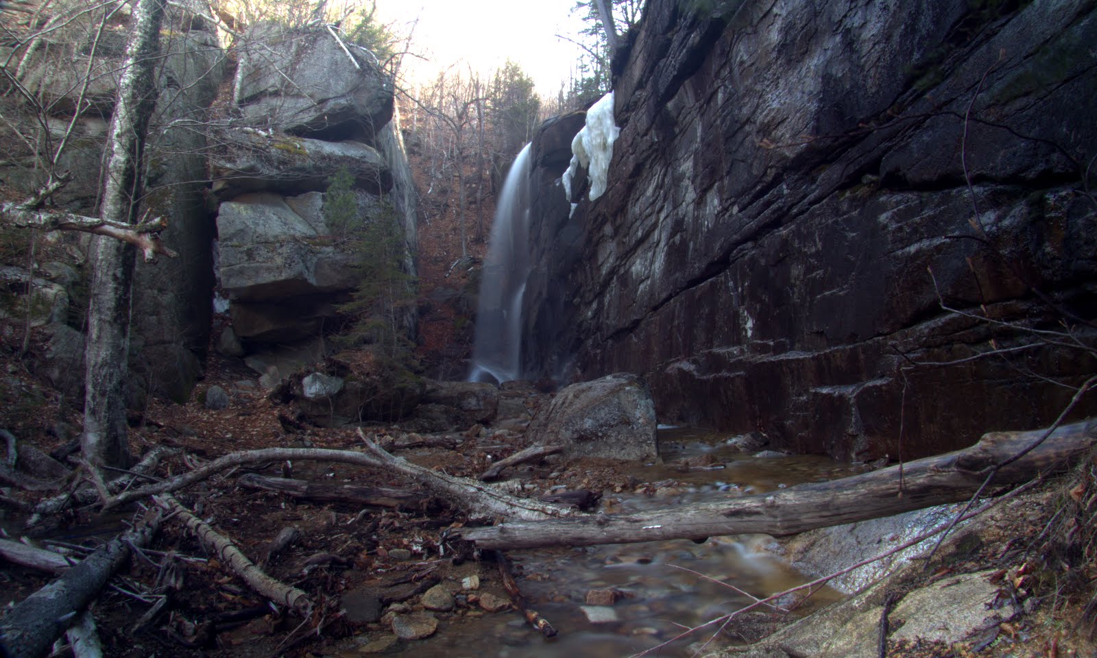
I arrived at the falls and got set up to take the long exposed photos of the falls. First, Pitcher.
Next up, Champney Falls and Cascades.
Believe it or not, it took me almost an hour to get the few photos I was happy with. It was fairly windy so I constantly had to wipe mist from the lens. After I was done I went to the top of the cascades for a quick shot.
I packed everything up and started the steep climb to the ledges. First ledge, just above Pitcher Falls.
The next steep climb.....
Brought me to this ledge.
Champney Falls
Three Sisters
Going up some more and ledge #3 comes into view.
It's tough to tell from my photos but this is chunk of ledge was split off the main body. There's about a 3-4' gap, 20' long by 20' deep. I couldn't get a good photo looking down in this one. Played it safe for once. ;-)
Decent views NW
The next ledge was a tad higher and little more north. Complete with fire ring and kindling.
Nice view up the Kancamugus.
Zoomed
Super-zoomed. :)
More northerly.
Bear Mtn
Carrigain
I continued to the high point of this bump which I thought might have a view. It was ledge but surrounded by trees.
I had one more, the 5th. ledge to check out on the south side.
This was all it yielded.
I basically started this whack from just below Pitcher Falls. I would however, be headed off this bump in a NW direction and re-connecting with the Champney Brook Trail. The woods were open, but steep in spots.
Eventually meeting up first with Champney Brook.
And shortly after, the trail.
Out at 10:00 AM. and hike #1 in the books.
Now for hike #2. As I've mentioned numerous times, I love to look at Google Earth in an area where I'll be hiking for hidden gems. I found something on the SW ridge of the Moat Mountains. My Garmin GPS maps have them labeled. The lower is Eagle Ledge and the upper Haystack. I did no research to see if those are official names. It looked to be a fairly easy bushwhack, maybe a mile, off the Moat Mountain Trail up a ridge which looked to be all hardwoods. Here's 2 GE images showing the spots.
A closer look of the ledges.
Here's is where I'm going to make a long story short. I drove over to the Moat Mtn trail-head and set out. I realized I'd only been to South Moat once, and it was totally socked in. So I decided to skip the bushwhack and just do South Moat. What do they say? "Never second guess". First, the second half of this climb is pretty steep and it kicked the crap out of me. Too much time off. I think the bushwhack would have been easier. Second, I'd slowed to a crawl and the clouds moved in before I summited. Probably could have gotten to the ledges faster. And lastly, I should have saved South Moat as a warm-up hike for Becky since she missed out on the views from there as well. I had pretty good views but not great so a return well be justified. 8)
Great day to be out!


Excellent exploration, Joe! I love doing this type of adventure.
ReplyDeleteRegarding the one ledge in your lineup that had no views, I can relate to this! I too have bushwhacked to openings (ledges, or whatever) that showed up on GoogleEarth, and then found that the views were limited (or non-existent). However, as I'm sure you'd agree, it's still a fun adventure to visit new places, views or no views! :-)
Very nice report. Thanks for sharing!
John
Thanks for the comments John. And yes, it's always rewarding just to explore new, and out of the way places.
ReplyDeleteGreat report, Joe! There's an almost infinite number of ledges to explore on the spurs of Chocorua. The same could be said of the South/Middle Moat spurs. Great area on a sunny spring day.
ReplyDeleteThanks for sharing all the fine photos.
Steve
Thanks Steve. There seems to be an infinite in those two areas, and a few other choice spots in the WMNF. I only hope I can find the time to explore a fraction of them.
ReplyDeleteJoe