Monday, May 23, 2011

Wonalancet Hedgehog, Hibbard and Wonalancet Mountians 5/22/11


Not wanting to stay home a second day this past weekend I decided to do a short loop over a 3K I needed to hit for my NH3K list. Wonalancet Hedgehog. I did this loop counter clockwise using Old Mast Rd., Walden Tr., and Wonalancet Range trails. Roughly a 6 mile loop. I started out from Ferncroft on the Old Mast Rd. around 10:00am.
I came across my first wild flower very near the trail head. A common Wild Violet covered with beads of mist.
I next crossed a small bridge spanning Spring Brook. I'd have to stop there at the end and take a walk up the brook for some photos.
This was not the type of weather I was hoping to do this loop in but the wetness was making the colors pop. especially the greens of the newly foliated hardwoods.
I started seeing dozens of  Painted Trillium. Many of which were wilted by the amount of moisture on them but plenty that were picture worthy.
I soon entered the Sandwich Range Wildness.

As I gained elevation on Old Mast Rd. the fog started to get a thicker adding to mysteriousness of the forest on this day.
I'm not sure why but I didn't see any Wake Robin Trillium until I got a little higher in elevation. And most were starting to show signs of being past peak. I did manage to find a couple intact. 
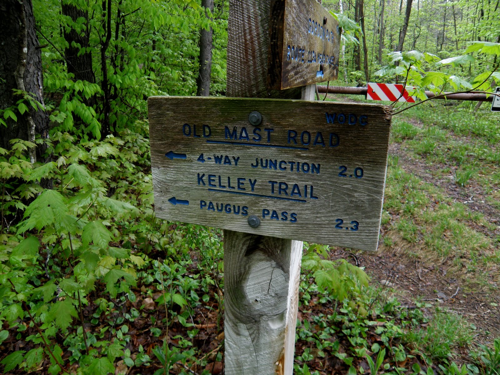
I was now at the junction with the Walden Tr. I'd be taking a left here and heading for Wonalancet Hedgehog.
This trail started out with relatively easy grades but soon became quite steep. And to add to the difficulty on this day, sections of wet ledge.
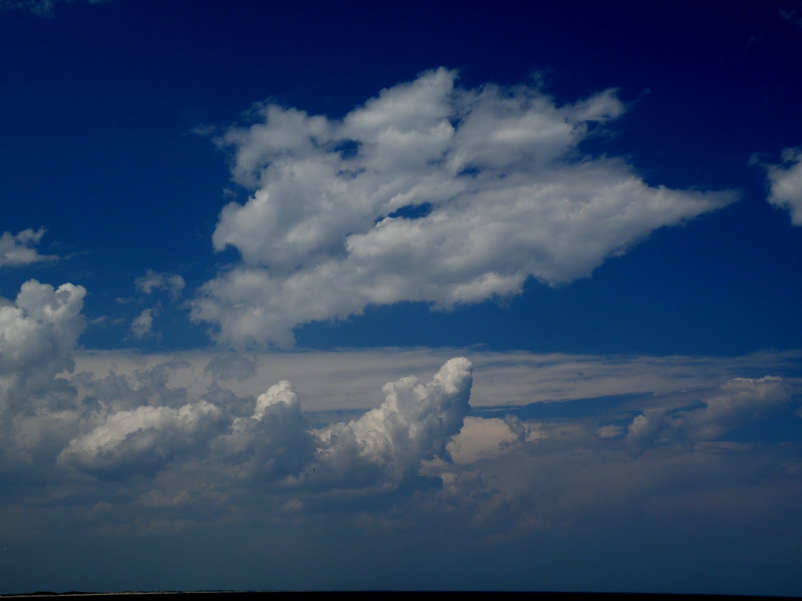
I came to a sign about 100 feet before the summit pointing to the views. There would be none today. Very disappointing for this views whore.
After checking out the non-views, I headed for the summit. Which is basically where this large boulder sits. I was told, (had views been possible today), it's not worth climbing to see more.
No point in sticking around here so off for the Wonalancet Range Tr. Which I came to about 15 minutes after leaving the summit.
This was a pretty section of woods and a fairly interesting trail.
The next stop would be Mt Hibbard for 52WAV. But since this list is compiled of mountains with views, I'm not sure I can cross it off my list since there were none. What do you think?
Well, it was off to that last summit of the day, Wonalancet. About .4 miles before the summit I came across this sign. Frankly, I wish I saw many more of these signs when hiking. :-) Yes, it does say short-cut. I could have just taken said short-cut since there would be nothing different to see on Wonalancet but I just stuck with the plan.
I passed over the summit of Wonalancet and started my descent. I came to a section of ledge that would have afforded views but my concern was how wet and steep it was. It took some doing, but I managed to past it staying on my feet.
The rest of the Wonalancet Range trail was much of the same, Steep. rocky, rooty and wet. It was slow going for the next mile.
Once back to lower elevation I was in the Trillium garden again. I know they all seem to look the same but there's always that subtle difference that makes it picture worthy for me.
Nearing the end of the I went off trail and down a small ravine to where Spring Brook was. This is one of my most common things I do when hiking. I hear a brook, I go find it. 
After that, it was a short trip back to the car. I would have liked to have had the views but a lone walk in the woods always has it's rewards


Saturday, May 7, 2011

Crane Beach Estate Ipswich Ma.


Becky and I decided to do a short hike in the Crane Beach Estate today since the weather up north wasn't looking good. I lived in Ipswich for about 7 years but have yet to take a long hike in the reserve. The weather in this area was beautiful. We parked the car and headed out.
There are about 5.5 miles of trails in the Crane beach Estate. They wind through the dunes and protected wildlife areas.
About 45 years ago when I was a child my family used to come hear for cookouts in the summer. The dunes were open to the public back then and had a much different look. They actually looked like SAND dunes. Now the area is mostly protected. In particular for the Piping Plover. A small sea bird which was nearly hunted to extinction in the 19th century. Crane Beach is one of the largest protected ares for them. Now the Dunes are covered mostly with invasive ground cover which I'm at a loss to remember the name. Along with various types of sea grasses.
On occasion you will see deer in there. The deer population was so bad about 20 years ago that they had to have a 1 week, off season hunt in this no hunting area to help control the population. There are also much more trees in the area than I remember as a child.
The wildlife was playing hard to get today as we saw nothing our four legged or winged friends. But we were simply over whelmed with the beauty of the dunes.
I managed to find only one flowering tree. I'm not even sure what it was. I do need to read up on plant life which I am sorely lacking in knowledge of.
From my countless stopping to take photos I hadn't seen Becky in a while. I finally spotted her up ahead admiring the views.
We continued along through the PUDS in the dunes getting closer all the time to beach. Which was go because in the dunes we were protected from the breeze and it was a bit warm. Again Becky took off out ahead of me while I slowed again for more photos.
I love the mountains but I must say I was having the time of my life with the photos. It was a pleasant change to the hundreds of photos I take in the mountains.
I caught up with Becky again to find enjoying the views from a great spot on a dune. And pleasantly breezy.
We were very close to the beach now and I was looking forward to walking on more solid ground. The trails in the dunes are mostly sand and tiring to walk on at times.
We finally made it to the beach after hiking about 2 miles in the dunes. We were treated to a nice ocean breeze and a wide open beach.
Now it was just a matter of walking the beach back to the lot and the car. It was a nice walk on the beach but a bit disappointing  that we saw no Piping Plover, no Terns, not even a Seagull. Just miles of beach.
We passed one of the many nesting areas for the Piping Plover along the way.
Once on the beach I was over taken by the clouds. The front that was moving in was producing some beautiful cloud formations.
One last shot before heading up the boardwalk for the the car. A picture across the bay towards Plum Island. Pretty nice way a salvage the day.


Tuesday, May 3, 2011

Big Coolidge Slide

I decided to head out from our condo at the village and check out the slide on east slope of Big Coolidge Sunday. I went in the woods the behind the condo and headed out. I passed a beautiful section of Clear Brook.
From here I started to ascend and slab north towards the the area I felt I would find the slide. I love bushwhacking this time of year as well as late fall do to the fact that the hobble bush and saplings are not foliated. It makes for a much nicer whack when you have a clear line of sight in woods. And since these woods are mostly hard woods down low, it's even more open.
 At around 2200' it started to get pretty steep and rocky. This is only my second time in this area and I noticed the area is littered with glacial boulders of all sizes and shapes.
 I'd been climbing for about an hour and a half and was not seeing any signs of the slide. I was at around 2400' or so when I decided to slab more north to see if I would run into it. It took all of about 5 minutes of doing that when I fially spotted it.
Once at the foot of the slide I gazed up at this gorgeous wide open slide. Roughly 200' X 150' in size and quite steep. Too steep to even consider climbing it.
The only way to get to top for the views would be to go just in woods to the side of it and head up. So that's what I did. This was not all that easy as the spruce along the edge was quite thick and the grade was very steep. To add to difficulty, it was also ledge. I popped out about have way up out to check out the view.
I continued to head up until I got to spot where it looked like I good have a safe place to sit and take some pictures. It wasn't at the very top but close. The views were great. Pretty much just easterly but unique.
After hanging out there I made my way up and over to the other side. I thought I saw spot where I would have a clearer view of Whaleback and it's slides. Again, this was pretty tough going as the spruce was thick and narley. I popped out again on the way to check out the view and found myself at a very steep section of the slide.
But I did find another spot to sit and take some more photos. Whaleback and the slides on it's ridge. This spot was a little safer perch than my first one so I sat there a bit longer and had a snack. What a gorgeous day, not a cloud in the sky.
Heading down the south side of this slide proved to be a little nerve racking. For in the woods I hit a 20' high ledge. I hard to skirt more south to get around it but it was extremely steep there and it gave a literal meaning to the term, "tree hugger". It wasn't long though before I was back in good woods and able almost jog my way out.
I made one last stop at a pretty section of Clear Brook before getting out. This took a little longer than I was planning but all-in-all, a great day in the forest.


ALL THE PHOTOS