Saturday, September 22, 2012

Western Slope of Agony Ridge Talus Field 9/16/12

Sunday was going to be just a clean the condo in Lincoln and head home kind of day. 3 long hikes Thursday-Saturday had me pretty sore. But while having my morning coffee watching New Hampshire Crossroads with Fritz Wetherbee I was reminded of a bushwhack I've wanted to do for some time. The episode was Franconia Notch. It was something I'd spotted from Cannon a few years ago and thought would make for an interesting and quick hike. The title of the blog is the best way I can describe the spot. This is what I saw from Cannon.

So I packed a light bag and headed for Boise Rock parking area where I was going to start the bushwhack from. I'm not sure about this but I think Boise Rock may be the least visited spot in Franconia Notch. I use it more as a rest stop and almost never see anyone there. It is an interesting story though.

I'd be starting from about 1900' going to 2400'.  The woods from the lot were nice and open.

Somewhere around 2250-2300' I started hitting huge boulders. 

I had to be very careful navigating through this area. I imagine these were a continuation of the talus but the centuries have covered most of it with earth. Carpets of moss were spanning gaps in the rocks making for some deadly moss traps. Well, maybe not deadly but certainly serious injury would occur if one was to step on one of these bridged gaps. So I made sure each step was on solid rock and caught a preview at 2350'.

I went up and north for another 50' and came out at the top of the talus.

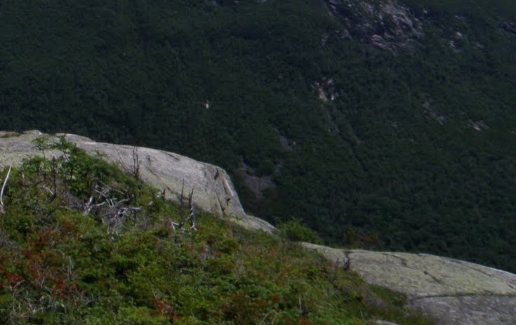
Pretty close-up and personal view of the Cannon Cliffs.

I think these feature on the Cliffs has a name but I don't know what it is. I have seen climbers in there so perhaps it's just a nickname they've given it.

No one on the summit tower yet.

From the top I didn't have a great view of the notch so I started making my way down. Many of these rocks / boulders were huge. I took one photo with myself in it to show some scale.

From this vantage point I had a better view of the Notch. South & North.

Profile Lake. I've yet to visit the new park with the Old Man profile.

A last look up and one more photo of the Notch.

I dropped back into the woods again having to slowly pick my way through the huge moss covered boulders. It may be hard to tell from a photo but this is the depth of the gaps in these rocks.

Once out, I was near the other end of the parking lot from where I was parked and noticed 2 things I hadn't noticed on the dozens of times I've driven through. Not much but interesting just the same. First this.

Then this.

Not exactly the perspective of the Notch I thought I would get from that vantage point but for a 2 hour romp, I'll take it. Below are tracks of bushwhack.


Wednesday, September 19, 2012

Big & Little Attitash 9/15/12

Today again, I was on a peak bagging mission. Big Attitash is another peak on the NH200 list. But since Big Attitash is a view-less peak, I also was on views mission. I spotted the ledges on Little Attitash last summer from North Moat Mtn. I figured when ever I hiked to Big, I'd bushwhack to Little. This is what caught my I from Moat Mtn. It doesn't look like much but unique views are worth the effort I think.

Started this one a tad late, around 10:00am. I didn't think I was going to be in for the day I had. The route was Moat Mtn Tr., to Attitash Tr. Bushwhack, and back to Attitash Tr. First up was Dianna's Bath. A beautiful spot if you can get there early enough. Starting at 10:00 on a Saturday won't cut it if your looking to take photos there. This one is from my trip to Moat starting at 7:00am.

Today I just motored past the already large crowd. This is a particularly beautiful area. I love trails that follow rivers, streams and brooks.

The first 2.4 miles went pretty fast arriving at the Attitash Tr. Once on it I expected to start climbing fairly soon, but it wasn't the case.   I will say this though, if you looking for a great low level fall hike, I think this would be outstanding if you only went about a half mile on the Attitash Trail and turned there. The woods are just gorgeous with a lot of hard woods. I did see some interesting fungi as well.

Back to the hike. The first couple miles on the Attitash trails was loaded with ups and downs. Every time I thought I was going up for good, it would go down just around the corner. In these ups and downs, PUDS, a large section of trail had been washed out by Irene I assume.

So once it did, it was significant. Once it started climbing for good, I believe it gained 1000' in .5 miles. Pretty hefty for a little mountain. Oh wait, Big. ;-)  All that for this, the summit. X marks the spot.

Now it was time to bushwhack to Little Attitash. I had planned to try the ridge to see if I could follow an old trail I thought was there but ran into pretty thick spruce so I started heading down until I hit a good stretch of goods woods. 

This was nice but I'd dropped to around 2100' to find it. Little Attitash is 2500' and 1.5 miles away so this was going to take some time. Much more than I planned on. The final push up was again fairly thick spruce. 
I've seen much worse but a was hoping for a cake walk.

I finally popped out at this ledge. It had a cairn on it confirming they may have been a trail. The views from the top of it were not that good though.

I thought I probably hit it a little too far west and just below the open ledges. It did appear to be higher to my right so I headed east. I did hit more open ledge with nice views towards Moat and N. Conway.

That was it though. I thought for sure from what I saw of them from Moat that there would be more expansive views. I kept heading east looking for more. I found much more ledge but nothing open. One peek of Washington in the clouds was it. I figured it just wasn't what I thought it looked like from Moat.

It took much longer than I thought to get this far so I headed straight down the east side for the Attitash trail. I didn't get out until almost 4:00. It was not until I got back to Lincoln and downloaded my tracks that I realized I screwed up. If I'd gone west only 100' I'd have hit the open ledges. Look how close I was. :(

Needless to say, I will be making a return trip. 


Tuesday, September 18, 2012

Crawford, East Stairs, and a Ledge....9/13/12

As I've mentioned in my blog, I'm pursuing the NH200. Thursday I decided on East Stairs, a bushwhack. The normal route for this would have been up Rocky Branch South Tr. to Stairs Col Tr. But since RB south is closed I had to go for a much longer, tougher route. Davis Path to Stairs Col Tr. I had 2 other objectives in mind. First was to climb Crawford on a much better day than my only other visit, (HHH and big time bugs). Second was to do a shorter bushwhack on the way back to a nice ledge off Davis Path NE of Crawford.

Said Ledge

I Started out on Davis Path at 8:00am. Davis Path is nice but once it starts to climb it doesn't stop until you hit the spur to Crawford. This has been more noticeable on my 3 descents on this trail after a long day. But it has nice stairs, and views.

I reached the junction of the Crawford Spur and headed up.

Where you hit the ledges on Davis Path, and continuing up the spur to Crawford, can be a bit tricky. The blazes are faded and far between in some places so it's easy to take a direction on the ledge that dead-ends. I did much better this time. Got off trail only once. 8)  And hit the summit around 9:30. 

Greeted by this....

And one of my favorite profiles in the Whites....

I had a lot more to do this day but I could not resist lingering for a good half hour taking photos.

As much as I hated to I had to move on. I had roughly 2.5 miles to get to a point I wanted to start the bushwhack from. I got to the Stairs Col Tr in about an hour. This would be the first time I set foot on this trail which is always exiting to me. 
  
Stairs Col
Looking up the bottom step

Came across this bottomless tree

As I often do in planning a hike, I neglect to look at the contour lines over the course a my route. Did not see how much elevation loss I would have to get to my starting point of the whack and hence the very significant climb back up to the col.

On the way down I did spot my objective.

I reached my entry point to find myself in thick saplings.

It did open up pretty nicely but was very steep to the col between Middle Stairs (don't know what else to call it), and East Stairs where it was quite open.


Heading east to the summit from the col was very dense pencil woods. Moving through this stuff was a slow process. Not sure how long it took but it seemed like it took an hour to go .2 miles. I did make the summit though. After doing so, it was an immediate retreat to a fir-wave just below the summit that looked like I might get some views from. 

Sure enough....

Now it was time for the whack out and the climb back up to Stairs col. Yippy! Now it was easier walking once back on Davis Path. I'd one more thing I wanted to do and that was to bushwhack to that ledge I mentioned in the beginning. It's on a ridge heading NW off Davis Path about .4 miles, and about .4 miles NE of Mt Crawford. I got to that point and headed in. It was very scrappy at first but hit some ledge. Then more scrappy. It was here that the only real problem of the day occurred. I hadn't noticed until my pant leg was soaked that the bite-piece of my hydration bladder had been pulled off. I shut the valve but the damage was done. Probably close to a liter was lost (started full at 100oz.) because there was just a mouthful left. I had to end my quest for that ledge. I was just few yards from the first open ledges (400 feet off trail), so I did continue to those which had nice views.


Time to end this journey. I hydrate a lot when hiking, in general for that matter, so knowing I was out of water made me all the more thirsty.  And as I mentioned earlier, descending Davis Path is tough on tired legs. For me anyway. But all I could think of was getting close enough to the stream that parallels the trail to get a drink. 

Salvation! I was not concerned about drinking from this at all. Drank my fill. A good liter, at least.

I finished around 3:30. Much longer than I'd though it would take. I will be going back someday to just explore all the "Ledgey Goodness" in that area.