I first spotted Sachem peak from Jennings Peak 3 years ago. It instantly caught my eye.
We looked at a map and firgured out what it was, and also saw there was no trails to it. Oh well. Now 3 years later having a couple years of bushwhacking under my belt it was time to go there. I also knew this would be a worthwhile destination from reading Steve Smith's blog. To get there I would be starting out on the Smarts Brook Trail, I thought.
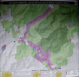
But I left my map at home which actually was a good thing. Because all my map shows is Smarts Brook Tr. from this trailhead. But looking at the sign I saw some X-country ski trails which would re-connect with Smarts Brook Tr. so I decided to use those. It would be the Pine Flats Ski Trail, to the Yellow Jacket Ski Trail, to Smarts Brook Tr, to the whack.
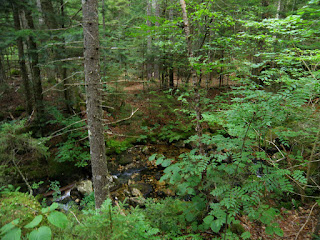
This was a lucky break this time, (leaving the map at home), because the Pine Flats Ski Trail paralleled an absolutely beautiful section of Smarts Brook. It's gorge was almost Flume like. If not for the very dry summer we are having it probably would be spectacular in there.
The good thing about the low water flow though was that I was able to pretty much pick my way though the gorge. I would not have been able to get some of the photos I did if I couldn't have gotten down in it.
From the Pine Flats Trail it was next to the Yellow Jacket Tr.
This was not as exciting. Pretty much your average X-country ski trail that's pretty boring to hike on. The woods were nice though.
Shortly after crossing the above bridge I came to the junction with the Smarts Brook Tr. Which at the point was still Smarts Brook Rd.
This was a nice area with some swamps and open fields. The road like section of the trail ended in this open field.
From here, the Smarts Brook Trail started a gradual Climb. I was seeing what seemed to be the theme of the day and that was just beautiful woods.
At .8 miles from when I started on the Smarts Brook Tr. I hit the Sandwich Wilderness.
I wasn't in the wilderness for more than a tenth of a mile when I saw this. Quite illegal seeing that it was only 20 feet from the trail.
Pushing on I got my first glimpse of my objective. Even from the partial view through the trees those ledges looked so inviting.
I finally reached the point on trail where I thought I'd head in. A short drop, a quick crossing of the upper reaches of Smarts Brook and I was in.
Looks pretty good to me. I'm not sure why you would, but if you ever want to find a blow down field let me lead. This was not much but it's just the principle. :(
It wasn't much past this point that the woods opened up and were beautiful. Not only did they open up but I came across a well traveled herd path. So much so it was almost trail like.
I was not bushwhacking at all. Just following a path in some gorgeous woods.
The next treat for me was an area that was littered with large glacial boulders. The photos don't show it but they were quite big.
So far there was nothing not to like about this trip. Had seen already many beautiful things and I hadn't even gotten to the views yet. Time to stop playing in the rocks and move along on trail. I mean whack. 8)
I knew I was getting close when the grades started getting real steep.
But where would I hit the peak was the question. What I was hoping for was to approach the ledges from behind so to speak. I was having such an easy time that I really wasn't looking at my GPS to see exactly where I was. So of coarse I came to the foot of a cliff.
Hmmm, now what. I had no idea at what point of all those ledges I had come to. A short distance to my left I spotted an area I might be able to ascend.
But when I got to the spot in the above photo where that small shrub is in that little notch, I saw a rock climbing anchor. Which meant this was not the route for me. I could also see from that point that this turned into 30 feet of straight up. But I also could see from there where I'd have a shot at some more woods. This is better.
And before I knew it, I was there. Wide open ledge.
I was sort of in the middle of these ledges which I believe is Acteon Ridge. Which Sachem Peak is part of. I wanted to go to the eastern most ledges first so I re-entered the woods briefly and came out looking right at the peak which I first saw this one from. Jennings.
From there I had pretty much 360 views. Unfortunately it was a little more overcast than I was expecting and that damn haze that's been around most of the summer was present.
After a few photos here I headed back to the more western ledges which were more open to take a nice long break. Found lunch on the way back. :)
After a few handfuls of blueberries I found a spot to sit down, have lunch, and just enjoy the solitude.
Before heading down I took the mandatory, 50 more photos. Clouds and haze don't stop me.
I had a second target in mind today and that was Bald Knob. Another ledgey bump on this ridge. So I headed SW until I ran out of ledge and dropped in.
The woods here were just the same as what I encountered on the trip up. Very open, large boulders and herd paths.
Of course I found the blow downs.
But just great open woods which was just as easy to move through as any trail.
There was a bump between me and Bald Knob that I had to climb. Not real steep but enough to make start feeling the effects of a 14 mile hike I'd done Saturday.
After cresting this ridge I made the call that I'd seen enough from Sachem Peak that Bald Knob was too much at this time. So I starting making the long and gradual whack back to the Yellow Jacket trail. There was no point in heading straight back to the Smarts Brook trail as the woods were simple gorgeous and very easy going.
This was a wonderful walk which took me over ledges and through beautiful fields of fern.
For the last 1/4 mile of whacking I ending up in drainage that I couldn't seem to shake. So I said what the hell, it's totally dry and easy to follow. Right back to the trail. :)
It hit the Yellow Jacket Trail about .1 of a mile from the junction with Pine Flats Tr. Only .8 miles to go.
Wonder why it's called Pine Flats. 8)
I couldn't resist taking a couple more pictures of the gorge, from above this time.
Roughly 8.8 miles, and 6 hours later I was back.
This was a fantastic trip which had a little bit of everything. I can say with a great deal of confidence that I will most likely return here on a bluebird day in the fall.
GPS Tracks


No comments:
Post a Comment