Wednesday, July 11, 2012

Two Days in the Pemigewasset Wilderness 7/8&9/12

Trip objectives: I needed to get off my butt and do at least a 2-day backpacking trip and stealth camp in the wilderness. I wanted to try and find a couple of the most remote old logging camps. And I wanted to bushwhack to an alpine zone on Mt. Bonds east ridge. The idea was to backpack to an area on the Thoreau Falls Trail near Jumping Brook, set up camp, and start hunting for some logging camps. That was to be day one. Day two would be to whack to the east ridge on Bond.  At first I was going to get to this area by using the Zealand Tr., to Ethan Pond Tr., to Thoreau Falls Tr. But I'd only been on the East Side Tr. Twice. Once for just a short distance to start a bushwhack and the second time it was on a overcast-rainy day just past the Franconia Brook Tentsite. So after reading a couple reports on The Mountain Wanderer's Blog of the East Side Trail and wonderful views along the way, I decided to do a longer and perhaps more tedious route to my target area. So the route was to be East Side Tr., to the Wilderness Tr., Thoreau Falls Tr. On my return the second day I did ford the Pemi East Branch down stream a bit from the removed bridge where I found a spot that I could mostly rock-hop and just had to go through 6' stretch of knee deep water that was moving at a moderate pace. Pretty safe but did the usual unclipping of all the straps on my backpack just in cast I fell. Then back to Lincoln Woods via the Wilderness and Lincoln Woods Trails. That's the gist of it.

I only completed objective #1, the overnight at a secluded spot. Because of a glitch on the outset, a 7:30 start turned into 10:30. With the late start I wasn't going to be able to check out any logging camps between there and where I was camping. Which I'd be passing a few. And with the miles I had and stopping to smell roses along the way (not worth the effort of you don't) I didn't get to my target area until 4pm. No time or desire then for logging camp hunting. But I did spend 4 glorious hours before bed enjoying this gorgeous remote area. In the morning I really only had 3 hrs before I wanted to start the long trek back. I decided to give camp 23a a go. Some hints I may be close but no luck. From what I've heard, a LOT, more time is needed to find this one. On the way back when I got to the Franconia Falls Trail I said to myself no way you can do this with another 3 miles still to go and a 2.5 hour drive home with it now being 3pm. That quickly changed to, no way you can not go there. Hadn't been to the falls since 2007. After that, 3 miles on the said to be, most boring trail in the Whites. Wasn't so bad, all things considered.


Heading out.


Views along the Pemi near Pine Island.

View from the bank just past the the Franconia Tentsites.

Another view further up the East Side Tr.

Some of Irenes wrath on the Wilderness Tr.

All that's left of the removed suspension bridge other than a large cable not in this photo. 

Thoreau Falls Trail bridge over the East Branch. Looks like it could be next to go.

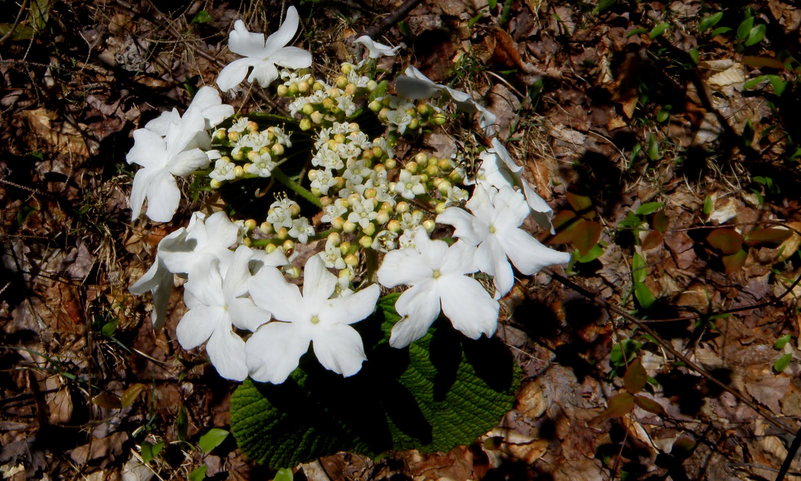
Once on the Thoreau Falls Trail I saw some wildflowers, a couple artifacts, lots of straight railroad grade, and more Irene damage. I had a good fall at that spot.


Shortly after this damaged section the trail seemed to turn into more of a herd path. I'm not sure but I think this was some sort of a reroute because I was climbing and slabbing the west side of Shoal Pond Peak. I was near enough to where I wanted to cross the North Fork so I dropped down and did so. And in a matter of  10 minutes found home. What luck.

This spot probably just makes the 200' rule. I'd have to call this legally, nonlegal. As obviously a trace has been left. But there was no way I was dismantling that thing when I left. So here it would for the night, not to shabby. And this spot I believe is basically on the side-track bed going to camp 23.


After a great evening here, and a peaceful nights sleep I broke camp and set out with a small pack to hunt for camp 23a. Once while having a conversation with someone know who does this as more than just a hobby, said, (I believe), it took him 40 hours to find 23a once he stated looking. Hey, I could have gotten lucky. All I found was this cool remote pond at around 2200' and a peek-a-boo view if Mt. Bond.


I'd gone past my turn around time so I had to head back to camp to get my large pack and head out. Instead of crossing back to the messed up portion of the Thoreau Falls Tr, I decided to see if I could follow the North Fork branch of the railroad bed. I found that pretty easily and first found this memorial. Then an easy to follow rail bed. Which got me passed the damaged section of the trail and easily crossed back to the east side of the North Fork when it ended.


Jumping way ahead now. I crossed the East Branch Pemi and am now on the Wilderness Tr. I guess I didn't need to go so far to see old logging artifacts.


As I mentioned, I decided not to pass on going to Franconia Falls. Can you blame me? 8)


Now it was just the 3 mile, so called boring walk, on the Lincoln Woods Tr. back to Lincoln woods. On the way I did something for maybe the 3rd or 4th time on the journey. I went to the edge of the bank to take a picture not realizing 'til this last time I was standing on earth that was undercut by the high water from Irene.
Not the brightest thing I've ever done. One of the dumbest though.


The long and short of it is, I was skeptical on whether or not I'd enjoy a mostly low-level trip. Well....


Monday, June 25, 2012

A Steamy Romp in Zealand Notch 6/21/12

I was up north for 4 days and Thursday the 21st was the only day I had a chance to get out solo which I enjoy immensely. Unfortunately the predicted high for the day was 90. I decided on trying to knock a few things off my bucket-list in the Zealand area. Even with the heat I was going to try and hit 4 spots I wanted to. 1...the talus slopes on East Hale. 2...Zeacliff Pond. 3...A view of the Pond 50 feet off the Twinway Trail. And lastly 4...Bushwhack past Zealand's summit to check out the talus slopes on the west side of it's north ridge. I can tell you right now, I've still got #4 to do. I'd planned an early start to try and do as much hiking with the temps low but even at 6:30 it was 70*. Just as I was about to head off on the logging road at the end of Zealand Rd. I ran into a fellow I'd hiked once before with who had a bad hike Wednesday because of the heat. I won't get into details but he had to spend the night in the area and had to get back to his car which was at the end of Haystack Rd. It was an easy call for me to say, "Let's go". This set me back almost an hour but finally got on the logging road at 7:30 and was soon at the clear-cut with a nice view of my first objective.
Although this clear-cut offered great views, it was very difficult to walk in. I'm not sure but I believe this area was logged about 3 years ago and what I call the leftovers, for lack of a better term, was thigh deep in spots. I opted to get to the edge of the woods and just bushwhack. Once to the other side and now pure whacking, I came to my first head dunking spot which was already needed.
After a good soaking there I continued to bushwhack through great woods west until I reached the foot of the talus.
I've been on East Hale before but that was a bushwhack from the Hale Brook Trail. Some friends eventually want to visit E. Hale and I will be recommending this route. Although this talus seemed slightly unstable to me, carefully ascending was pretty easy. I pretty much went to the top of this first section where the vegetation starts and had great views. A bit hazy though. And this would just get worse throughout the day.
Next up was Zeacliff Pond and my second set-back. My first though was just to bushwhack on a SE heading for the Zealand Tr. so that's how I set off. Then I thought in this heat I didn't really need to be bushwhacking too much and was going to just head back the way I came and basically start over on the Zealand Tr. at it's beginning. Then second guessing myself again, I thought after seeing great looking woods heading the way I wanted to go, I decided to just go for the whack. See, looks awesome.
Well after going over the top of this unnamed bump at 2565', I was in killer hobblebush. 6-7' tall and as thick as I have ever seen it. So thick that the branches of each were tangled together making it extremely tough to push through. At this point I was already committed. I was in the middle of this when I heard a thump, crack, whoosh, and a brown flash. No picture but yup, I almost stepped on a moose. All I can think is that in the heat it didn't really want to move. It was probably thinking, "Crap, I'm actually going to have to get up because this butt-head's going to step on me. I think I was only about 15-20 feet from doing so. Scared the crap out of me. This one mile or a tad more whack took an hour and a half, and sucked a ton of energy out of me. But being close to the beaver ponds know, I knew a good head soaking would do the trick.

Jumping heading ahead a bit now. I'd plenty of water spots now to cool myself in plus I was carrying one, 1 liter bottle solely to keep filling to douse myself with occasionally which was working nicely. It was a bit tough in this heat but slow and steady got me to Zeacliff for some very hazy views.

Next up was Zeacliff Pond. Rahter the view of it from off trail at around 4000'. The only reason I knew of this was while looking at Google Earth for something entirely different, I clicked on one of those picture icons and got this. A pretty cool view about 50 feet, through thick stuff, off trail.
It was here that I knew there was no way I could continue to Zealand and the talus slope on it. It was now around 1:00pm and hot as hell. So I just had enough to descend to Zeacliff Pond to check it out. I'd only been this far twice before and bypassed it on both occasions. Peak-bagging does that to you. It was worth checking out.
Now it was just a matter of getting back to the car as quick as possible where there was a treat waiting for me in the cooler. I passed up on Zealand Falls on the way up but thought I'd make a quick stop on the way out to take a couple photos. But when I got there it was littered with what I assume were to be overnight guests at the hut. I was slightly angered by this but I guess I could not blame them at all. Was kind of jealous actually. I had to settle for the cascades just bellow. Which I soaked my head in as well.
Then I was back at the ponds which are just gorgeous. 
The day was taking it's toll on me. I love the Zealand Trail but that first half mile or so in that rooty-rocky section was tough on spent legs.
I was finally out at 3:30. Hot, tired, and in much need of what was in that cooler. I'll admit this was a bit much on such a hot day but all-n-all, I handled it pretty well. Would have been nice to have made it to all my objectives though as the talus on Zealand was the one I wanted to see the most.

 Hopefully it will be there for a couple more years. :-)

Tracks


Tuesday, May 15, 2012

Greens Cliff / First Ledge at 2200' 5/12/12

Saturday my significant other and I hiked Blueberry Mtn in Benton. Beautiful hike but fairly short and quick, we were done by noon. With such a gorgeous day, I myself was not ready to call it quits. So I dropped the girlfriend off in Lincoln, had a bite to eat, and decided on Greens Cliff. The intent was to hike all the way to the true summit for NH200. After a lunch I headed east on the Kanc. for the Sawyer river Tr. I started out with water shoes as I knew the crossing of the Swift River was a bit high and didn't want to spend a lot of time searching for a route across. The photos below are the cascades just above the crossing and the crossing itself.
After making it across I switched to my boots and headed of on trail. The plan now was to head in a couple 10ths of mile more or less and head up the west ridge of Greens Cliff. Looking at my map I noticed I had another crossing of Meadow Brook. Never having been on this trail I didn't know that I would be able to pick up an x-country / snowmobile trail with a bridge over Meadow Brook. That works.
I myself have not seen much for wildflowers this spring. All I could come with was some Painted Trillium and Hobble bush on the way in.
Shortly after crossing the bridge I started my ascent up the ridge. I thought I saw more hard woods down low from the Kanc. but my starting point was in fairly open but scrappy rock and ledge laden area. A little tough going after having hiked earlier.
The woods started to open up a bit but now it was fairly thick, young hardwoods. 
I was starting to feel a little beat and my legs were stinging since I decided to try this one in shorts. Never again. I decided I was not going to make it to the summit after about an hour and a half of slow going so I headed instead for a ledge I knew was at about 2200'. I started pushing south and within .1 miles popped out on the ledge. 
Now I had stopped at The Mountain Wanderer in Lincoln on my way through. In talking to Steve Smith about my plan, he said if I only made it to the first ledge, that was a worthwhile destination in itself. No argument there. Fantastic views. 180* or a little less.
I took my usual, too many photos, then took a nice break. The skies were blue and breeze was blowing. Alone on a ledge with views like this is indescribable. 
When it was time to leave, I decided to descend on a different route which landed me in some very thick saplings. Along with that. I hit  some bog areas which was bordered with thorns. My legs weren't happy at all. Did I say no more whacking in shorts? Looks innocent enough but I got pretty sliced up going through here.
I finally made it back to the snowmobile trail and spotted one more wildflower. Wild Violets, one of my favorites.
Took me about 3hrs. 15mins. to do this one. I'll be returning this summer probably, to get to the summit.
Great Bushwhack!

Tracks- Top ascent / Bottom descent

Photos of the ledge are in reverse order as I entered at the top and worked my way down.